CUT & SPILL [OVER] THE LOST ERIE CANAL
Syracuse, New York USA
Project
Urban Masterplan and Public Park
Client
The City of Syracuse and Town of DeWitt
Size
4 mi / 6.4 km
Awards
First Prize for Living Underpass
ELEVATING ERIE
The City of Syracuse and Town of DeWitt in upstate New York have begun transforming one of the largest missing gaps in the Erie Canal Park network along Erie Boulevard with an effort called Elevating Erie. OBJECT TERRITORIES won the "bridge" site of the competition, not by designing a bridge, but by designing a Living Underpass that follows the path of the former canal while avoiding all at grade road crossings seamlessly connecting Erie Canal State Park with Erie Boulevard. OBJECT TERRITORIES also received a notable entry commendation for the "branch" site with the design of a water depression that forms an an Inverse Wildlife Blind.
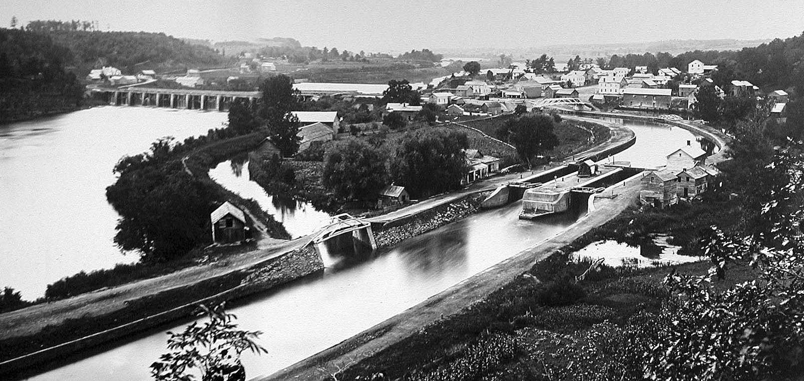
THE LOST ERIE CANAL
Completed in 1848, the Erie Canal was built 70’ wide and 9’ deep and ran 363 miles from Albany and the Hudson River to Buffalo and Lake Erie, connecting commerce from the Atlantic Ocean to the Great Lakes. After 1920, with the advent of the automobile and later the opening of the St. Lawrence Seaway, the canal was filled and paved in many places. Between Syracuse and DeWitt the canal has been repurposed as Erie Boulevard, a six lane access road for suburban big boxes and their parking lots. The former canal remains however - as a hidden landscape beneath this four mile stretch of Erie Boulevard.

ERIE BOULEVARD TODAY
Erie Boulevard is currently unplanned sprawl with six to seven lanes of asphalt and the occasional median. Parking lots for big box retail tend to occupy the North side of the boulevard while fast food restaurants predominate the South side. There are no sidewalks or bicycle lanes. Traffic studies have shown that Erie Boulevard could even be closed completely with traffic rerouted to other roads. The former Erie Canal lies just beneath the surface of the roadway.

ERIE BOULEVARD TRANSFORMATION - CUT
In our masterplan was designed as a subtractive proposal. A series of cuts were made not only to reveal the Lost Erie Canal, but to open the canal as a performative urban and ecological device capable of transforming the surrounding context. By rerouting the freeway traffic to existing roads to the north of Erie Boulevard the boulevard's road width can be reduced, transforming the boulevard into an extension of Erie Canal State Park to the East, connecting the State Park directly to the City of Syracuse. Revealing the Erie Canal that lies just below the surface of Erie Boulevard creates a new public amenity for recreation and use as a new multimodal corridor with space for pedestrians, cyclists, and buses while restoring wetland and forest habitats.

SPILL [OVER]
Cutting to reveal the Lost Erie Canal forms new urban spaces and ecologies that not only connect Syracuse and Dewitt to Erie Canal State Park, but also spills-over their urban and biological diversity into nearby communities and natural habitats.
THE FUTURE OF THE LOST ERIE CANAL
Large stretches of the asphalt roadway can be replaced with pathways for walking, cycling, horseback riding, swimming, and kayaking both following and weaving across the space of the canal. The addition of water and vegetation forms a park with two sides - one to the North side of the canal flush with wildlife, acting as an ecological buffer to the big box retail behind - and another recreational park facing a densified urban street on the South side of the canal.

PERFORMATIVE CROSS SECTION
Portions of the North half of the canal are excavated to the old stone canal walls forming hard urban edges for seating and a forest buffer between the canal and big box retail farther to the North. The South side is cut to form a variegated wetland condition forming a diverse wetland habitat the former canal never had while opening to a densified urbanism to the South.
LIVING UNDERPASS
Interstate 481 is the most significant barrier to connecting Syracuse to Erie Canal State Park - by definition this also makes it the most enticing opportunity. Bridging over the highway would invariably require an on-grade crossing for pedestrians, cyclists, and horseback riders at Butternut Drive. A bridge would be costly, require maintenance, and incur weight restrictions limiting the people and fauna that could cross the bridge. An underpass would create a new type of space in the park - a dramatic gateway that follows the exact path of the former canal, seamlessly joining Erie Canal State Park with a new Park at Towpath Road and Erie Boulevard. As a cut in the landscape connected to the ground it would create new habitats for various flora and fauna that live in the Erie Canal State Park. Bog Turtles, Ducks, Herons, Hummingbirds, Frogs, Salamanders, and Bats (important pollinators) would have a safe and quiet crossing and spill- over into the parks on either side of the Interstate. Gently sloping paths and large light wells in the medians of the highway would create dramatic daylighting conditions for people walking or riding through the living underpass. As a cut in the ground below Interstate 481, the underpass follows the exact path of the former canal providing a safe and quiet space for people, flora, and fauna to migrate. The tops of trees would eventually protrude from the openings in the underpass providing a kind of passive signage indicating the presence of the park connector running below the interstate.


INVERSE WILDLIFE BLIND
The branch site contains the largest wetland along the former Erie Canal Path. The former canal lies somewhere below, now completely subsumed by this wetland. As a part of the Cut and Spill[over] master plan it is as though the spillover already occurred. In order to connect the site to its surroundings a depression is made that allows for a gradual pedestrian ramping under Bridge Street which receives heavy traffic from Interstate 690. The path way is literally cut through the wetland forming a depressed wildlife viewing area. The lower perspective across the water allows for a more direct experience with the flora and fauna of the site. Water flows over the edges of the cut to expose the water and create additional flow and aeration for aquatic fauna. While people are viewing their environment, there may also be occasions where the relationship between the traditional observer (human) and observed (fauna) invert -the wildlife may also be watching us; bringing into question our anthropocentric world view. Cattail and mugwort plant species are grown in the areas adjacent to Towpath road and the big box retail to absorb heavy metal pollutants and toxins from road runoff.